The fastest way from
point A to B
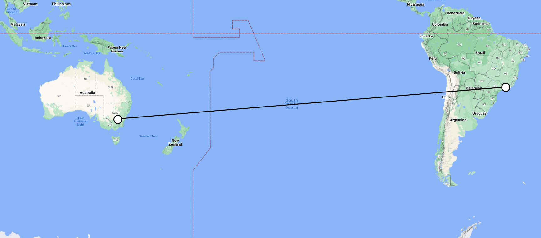
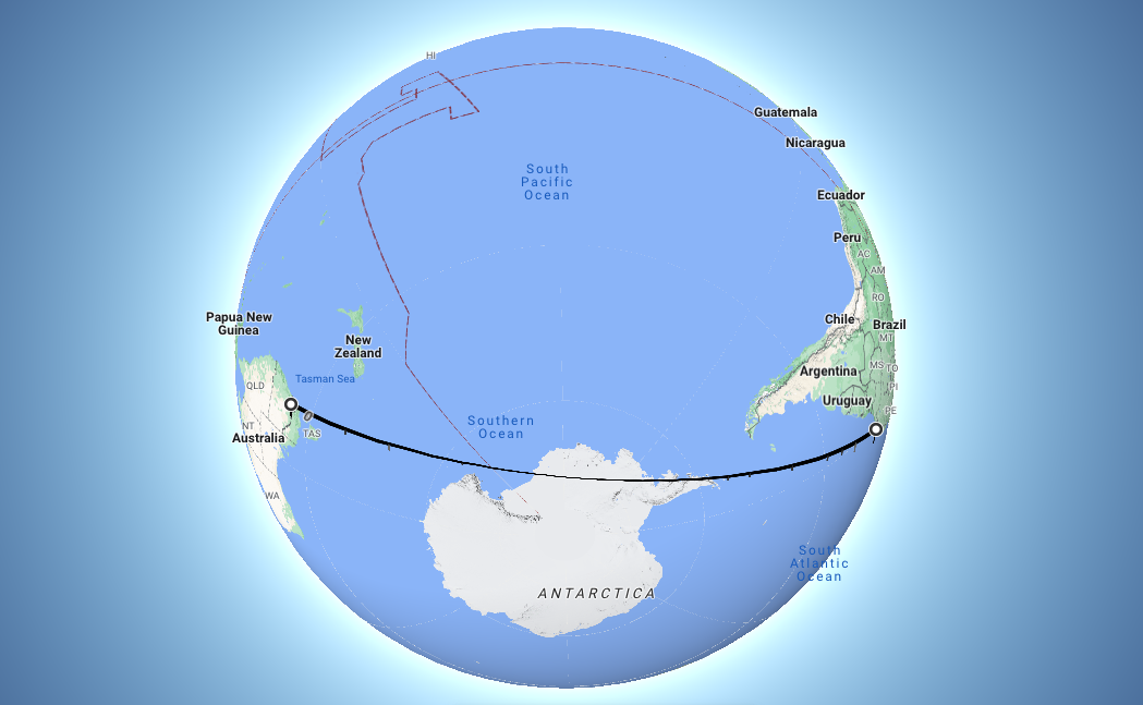
Have you ever gazed at a map, scratched your head, and wondered why your plane from Northen Europe to the US west coast takes a detour via Greenland instead of zooming straight across the Atlantic? Well, buckle up, and allow me to demystify this seemingly counterintuitive phenomenon.
First, lets talk about the Mercator map, the trusty cartographic companion that has graced classrooms for generations. Its square grid and seemingly straightforward lines make it a popular choice. However, there’s a catch: the Mercator map distorts the true sizes and shapes of land masses, particularly those near the poles. You can read more about this in my article: Greenland vs. Africa. The true size of the world.
This distortion can lead to some surprising flight paths.
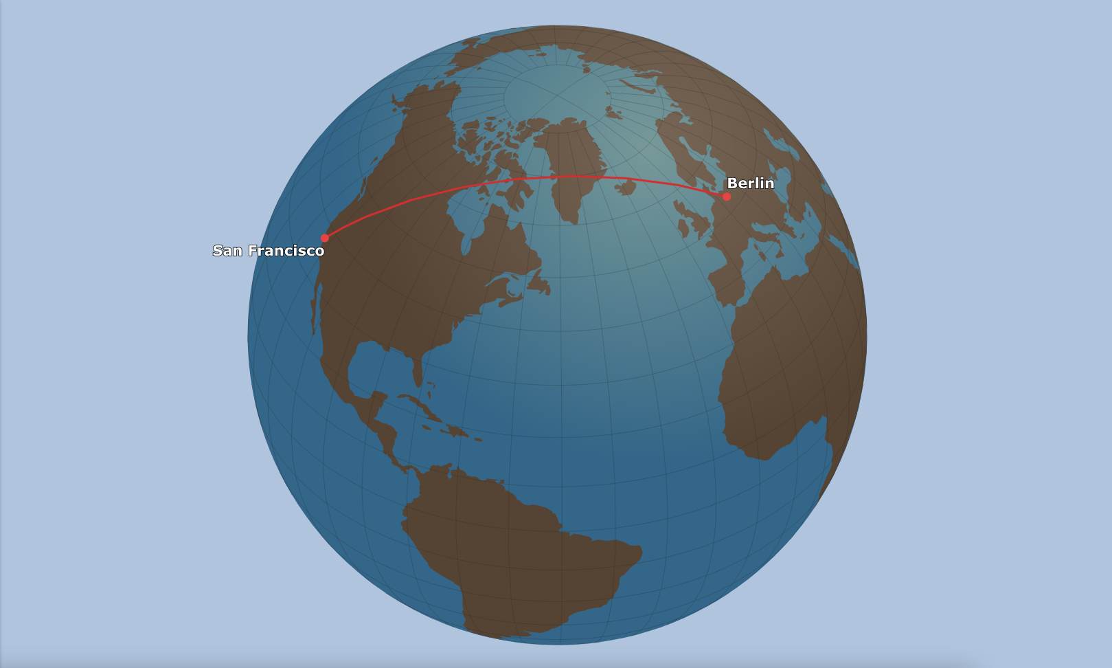
Imagine you're planning a dream vacation from Berlin to San Francisco. Consulting your Mercator map, you might draw a straight line across the Atlantic Ocean, thinking it’s the shortest path. Alas, this isn’t the case! In reality, the shortest distance between two points on Earth's surface is a Great Circle route. A Great Circle is the largest circle that can be drawn around a sphere, cutting it into two equal halves. Let's take a short look at two examples.